Paddlers and hikers alike looking for a small adventure in Downeast Maine should consider the Orange River Conservation Area.
Difficulty & Length: Easy to moderate. The Orange River Water Trail is an easy to access, easy to paddle flat-water trail. Paddlers can travel approximately 6 miles as they explore this area. The Estey Mountain paddle-access hiking trail is relatively easy with a short steep pitch at the end, .75 miles each way.
Town: Whiting
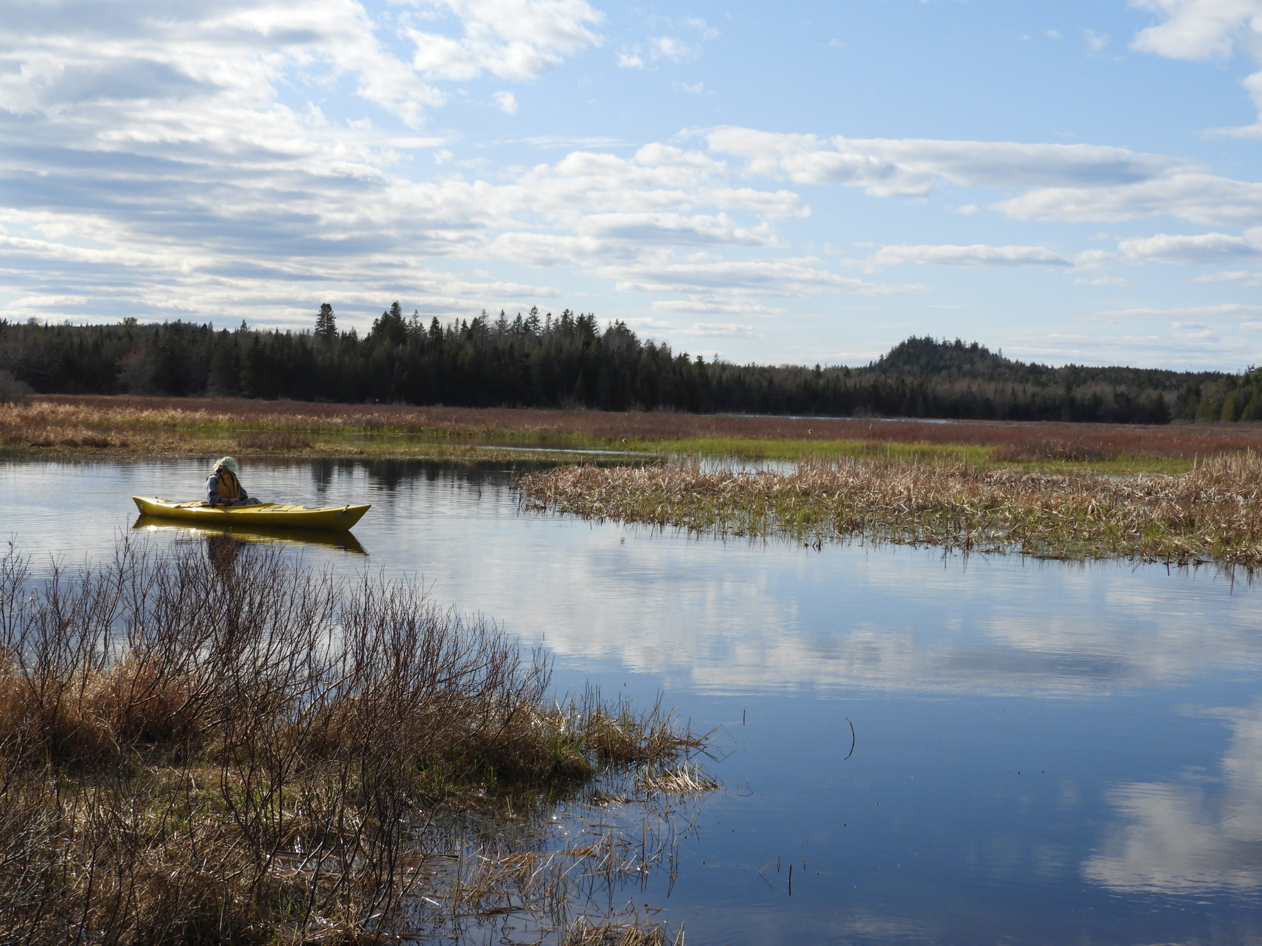
On an early spring day this May, DCC’s Outreach Director Cathy decided to take advantage of the warm weather and lack of biting black flies and explore the Orange River Conservation Area. Cathy’s small group of 3, choose to put in their kayaks at the Reynolds Marsh Overlook located off of Route 1 in Whiting. There is a short trail that starts on the left-side of the parking lot leads to the water access. This location provides hand-carry launch only.
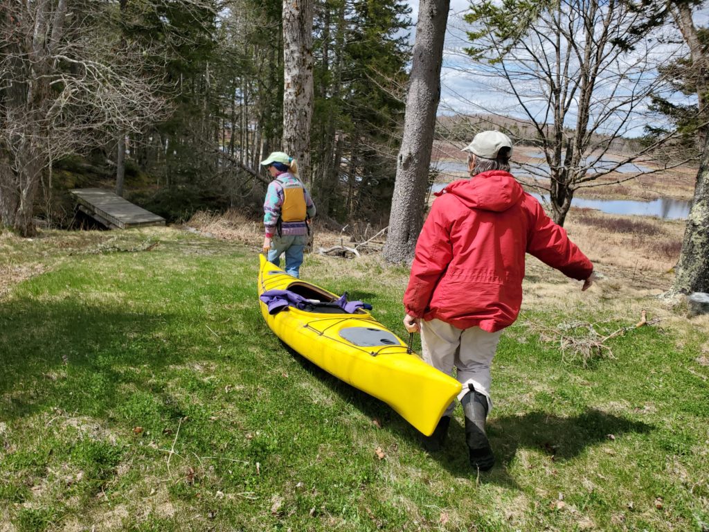
DCC also maintains the Orange River Landing, located on Playhouse Lane. This location has a 2-car parking area and launch, which is suitable for small trailered boats as well as hand-carry boats. However, please note the parking area is very small and space for turning and parking is limited.
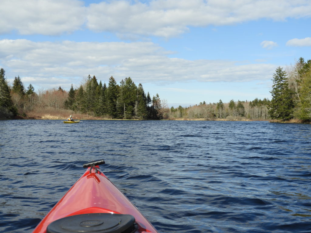
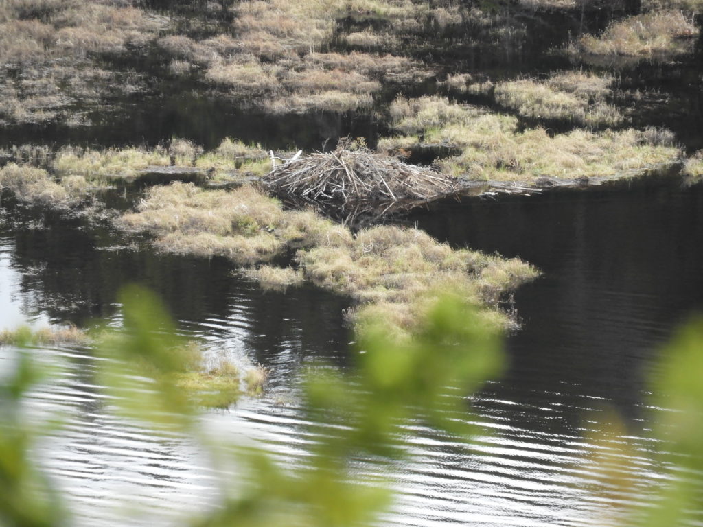
Once situated on the water, our small group began to explore the miles of fresh water. The marshes and wetlands that fringe the river provide excellent habitat for nesting ducks, as well as beavers, muskrat, otters, mink and many other kinds of animals. Along our journey, we saw black ducks, kingfishers, and numerous beavers dam scattered along the waterway.
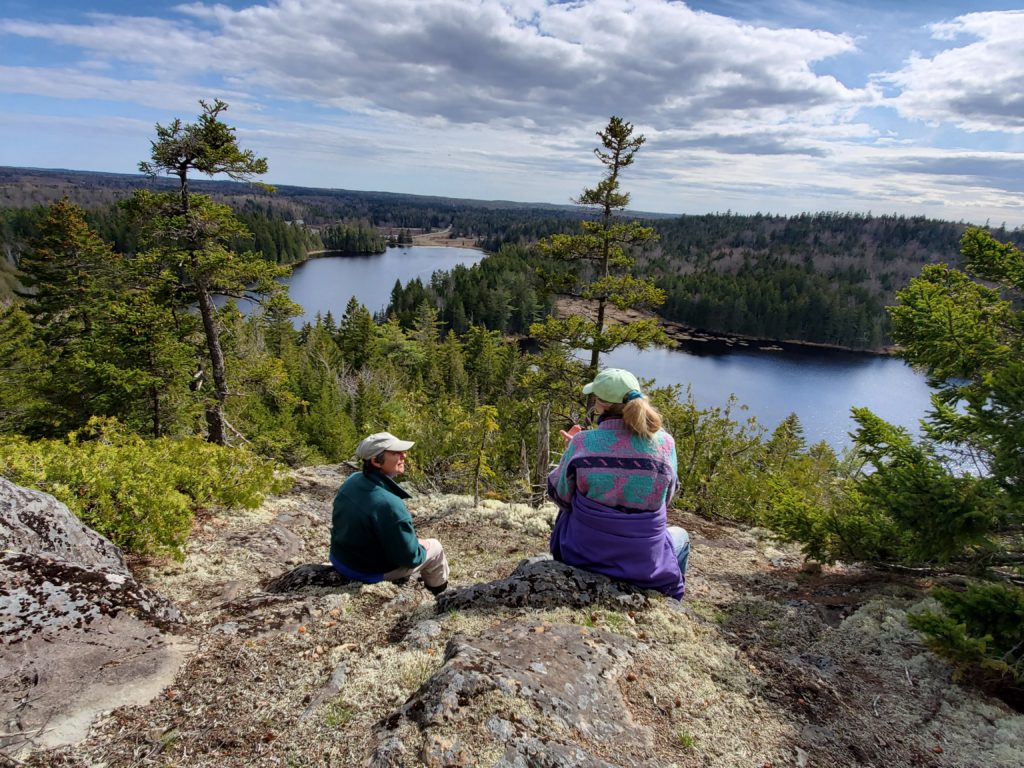
Paddlers are welcome to access DCC’s shoreline at designated day-use areas for picnicking, wildlife watching, and relaxing. Our group choose to stop at the Estey Mountain Trailhead to continue the day’s adventure. The paddle-access hiking trail of Estey Mountain begins as an easy climb through a forested-landscape. To reach the summit, hikers need to climb a short steep pitch at the end of trail and then you’ll be rewarded with stunning views of Roaring Lake and the surrounding wild landscape. While relaxing at the summit overlook, our group listened to a chorus of peepers calling off in the distance before heading down the same trail and hopping back into our boats to make the paddle home.
Much of the shoreline on the Orange River is under private ownership, please respect neighboring property owners by only utilizing the day use areas designated on the map.
History and Acquisition: The Orange River Conservation Area is comprised of several separate parcels protected by Downeast Coastal Conservancy beginning in 2003. Thanks to the support of DCC’s members, we have ensured that over 700 acres of land bordering Orange River, Little Lake and Roaring Lake will remain undeveloped forever. This includes over 9 miles of shoreline and 100 acres of important marsh, bog and swamp habitat. Orange River Landing was formerly the site of a steam-powered sawmill in the early 1920’s. Footings from the mill building can be seen in the bushes near the small boat launch at the end of Landing Road. The Orange River dam belongs to the State of Maine’s Department of Inland Fisheries and Wildlife. Water levels are maintained to provide optimal bird nesting habitat in the hundreds of acres of wetlands across the flowage. Paddlers should expect higher water in the spring and early summer and lower water levels in late summer and fall.
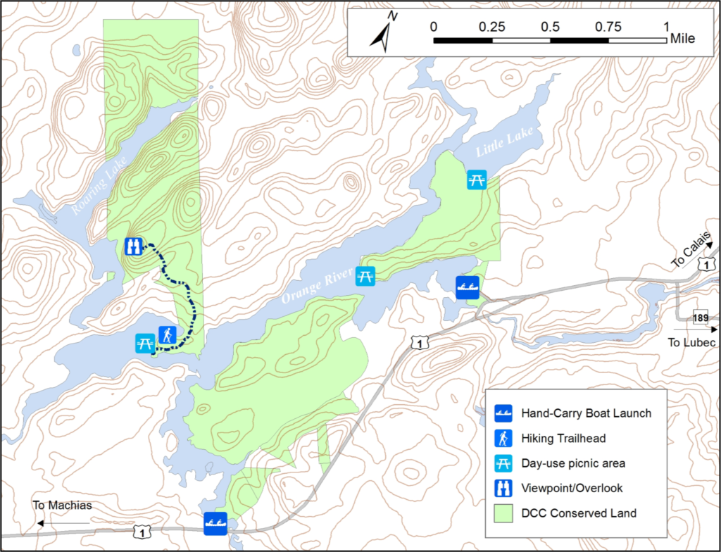
Directions: Reynolds Marsh Overlook: From the North, take US Route 1 to Whiting. Go 3 miles past the Route 189 turn-off. The parking lot will be on the right. From the South, take Route 1 10.2 miles past the Route 191 turn-off in East Machias. Look for the parking lot on the left. Orange River Landing: From the North, take US Route 1 to Whiting. Go 0.8 mile past the Route 189 turn-off to Lubec. Turn right onto Playhouse Lane. Go 0.1 mile and turn right onto Landing Road. Take Landing Road past the house (where it becomes dirt) to the end where there is a small 2-car parking lot. For larger groups or vehicles with trailers, proceed past Landing Road to the end of Playhouse Lane, then turn right and unload near the dam. Please park without blocking access by other vehicles. Overflow vehicles can park on Playhouse Lane. From the South, take US Route 1 12 miles past the Route 191 turn-off in East Machias. Look for Playhouse Land on the left and proceed as instructed above.